CONTACT US
 NEWSLETTER SIGN UP
Walk 1: Kirkheaton Boundary Walk
approximately 6.5km [4 miles]
A walk around the edges of Kirkheaton village
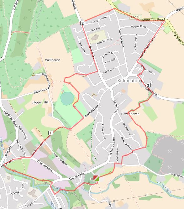 Down load directions here
- Start at Deadman’s Gate in front of the church and turn right onto the path [sp] between the two graveyards. This path goes under the old railway bridge, over Fenay Beck out onto Waterloo Road. [Could be overgrown]
Turn right and walk to the mini roundabout at Waterloo Road. Go right, cross the road and climb over the stile into the field [sp] Follow the stream until it meets Long Lane. Turn right and cross the road. Continue along Long/Crossley Lane to Cold Royd Lane. - Turn left into Cold Royd Lane and go up the hill following the flagged path until you reach the tarmaced road at the top. Turn right and continue along the road. Turn first left onto the access road to Kirkheaton Cricket Club just before the playground. Walk round the field to the gap between the cricket club buildings. Turn right behind the building and continue along this path towards the houses.
- At the junction turn LEFT and continue up the hill behind the houses. Follow the wall past the football field and go through a gap into scrubland. Follow the well-used path until you meet another path running left to right just after a wall.
Turn right here and follow it until you meet the main road - Cross the road and continue on the path behind the houses.[Sp] [If this path is overgrow retrace your steps to the road and turn left into Meadow Park] Cross where the path meets Moorside Road and climb a short flight of steps onto the main Grange Moor road. Turn right and continue to the traffic lights.
5. Turn right at the Blacksmith’s onto Heaton Moor Road. Walk down the hill towards the centre of the village.
Turn first left into Epsom Way and then right onto Newbury Close. Tucked in the corner on the right is a path that will lead you out into Cockley Hill. Turn left here and go up the hill until you see a footpath sign on your right [next to a house with a white garage door]
6. Turn down here and cross the drive to Broomfield House, to a shady path which leads downhill. Follow this down to a stile. Cross the stile into a field and walk to the next stile ahead. After crossing this make your way diagonally across the next large field towards a wide pathway which continues down the hill to a gap leading onto a tarmaced road.
- Turn right here and continue along Mountain Way until its junction with Stafford Hill Lane. Veer slightly left across the road to go over a stile [sp] Follow the path down to Laneside.
Turn right and in approx 100m turn left between the houses into onto a path [sp] through a field. Follow the path along the wall until you see a gap [could be wet here] leading to a ‘green lane’ with the Beaumont Arms beyond, and the church where you started, in sight.